| Home | Contact |
To see the full State map see: Library of Congress State Map Collections Follow the link for Nebraska, then for the 1874 Nebraska map.
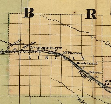
To see the full State map see: Library of Congress State Map Collections Follow the link for Nebraska, then for the 1876 Nebraska map.
To see the full State map see: Library of Congress State Map Collections Follow the link for Nebraska, then for the 1879 Nebraska map.
To see the full State map see: Library of Congress State Map Collections Follow the link for Nebraska, then for the 1886 Nebraska map.
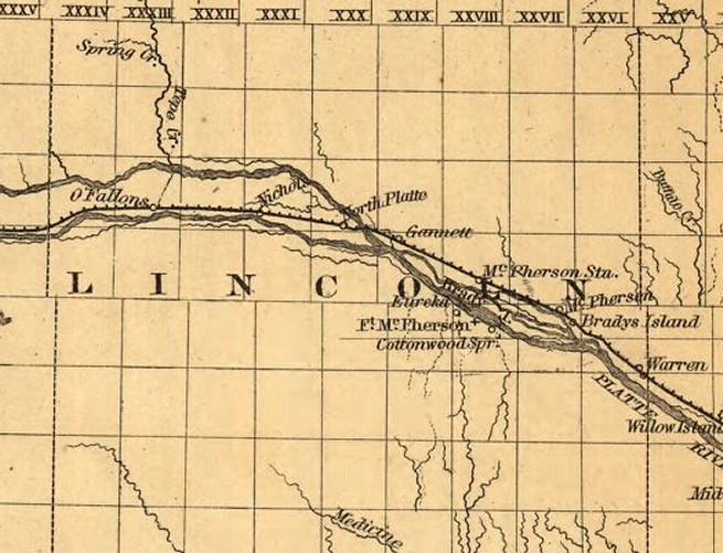
To see the full State map see: Library of Congress State Map Collections Follow the link for Nebraska, then for the 1879 Nebraska map.
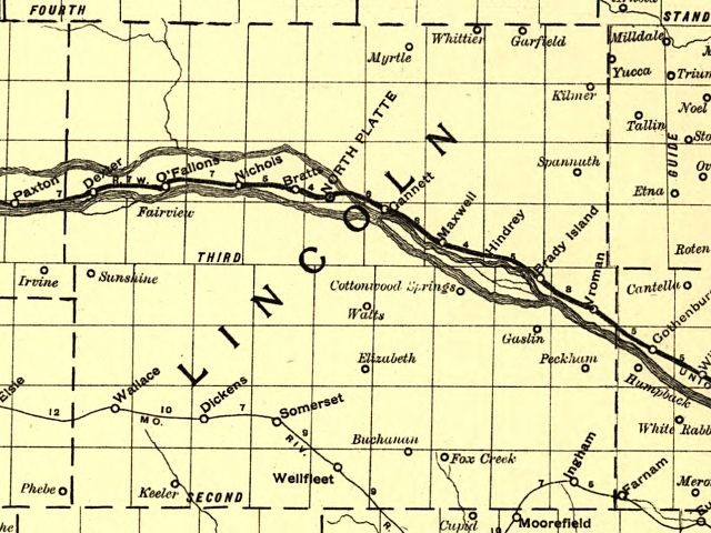
From a Railway map of Nebraska issued by State Board of Transportation 1889.
To see the full State map see: Library of Congress State Map Collections Follow the link for Nebraska, then for the 1889 Nebraska map.
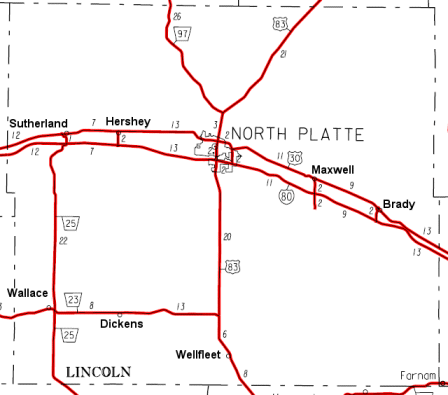
Found in the NEGenWeb Project OnLine Library. Check the county index for the Lincoln County map.
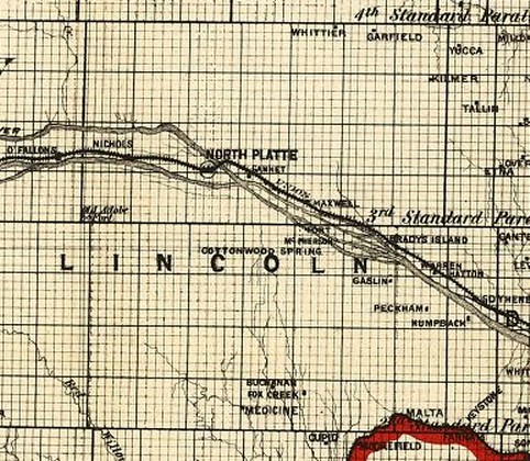
Showing routes and post offices of the Railway Mail Service.
To see the full State map see: Library of Congress State Map Collections Follow the link for Nebraska, then for the 1898 Nebraska map.