© 2011 Gosper County, part of the NEGenWeb Project
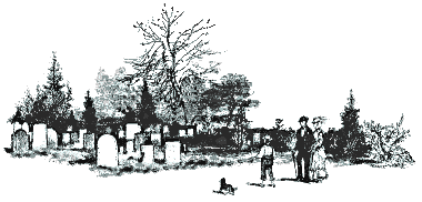
Gosper County Cemeteries
See also Additional Sources
|
Amish Mennonite/Yoder Cemetery Established December 1902 SE 1/4 S10 T6N R21W, Lincoln Pct. From Smithfield: Hwy N23, 2 Miles East, 4 Miles South, 1/2 Mile East. Cawthra Cemetery Established 1886 West Muddy Pct. On private land - not accessible by car. Deer Creek Cemetery Established 1897 West Muddy Pct. On private land - not accessible by car. East Muddy Creek Cemetery (a.k.a. Snowball Cemetery) Established December 1888 Photos W1/2 S8 T5N R23W, Elk Creek Pct. GPS Coordinates: DEC - Latitude = 40.4166728 Longitude = -99.9617930 DMS - Latitude = 402500N Longitude = 0995742W From Elwood: Hwy. 183, 12 miles South, 4 miles West, 1/2 mile North. Elwood Cemetery Established April 1899 Photos (Updated 20 Aug 2009) SE1, S5, T7N, R22W, Elwood Pct GPS Coordinates: DEC - Latitude = 40.5997284 Longitude = -99.8378980 DMS - Latitude = 403559N Longitude = 0995016W From Elwood: At stoplight on Hwy. N23, 1 1/2 miles East, 1/2 mile North. Fairfield Cemetery (a.k.a Detenbeck Cemetery & Fanter Union Cemetery) Established April 1893 NE1/4 S25 T6N R22W, Turkey Creek Pct. GPS Coordinates: DEC - Latitude = 40.4672288 Longitude = -99.7553957 DMS - Latitude = 402802N Longitude = 0994519W From Smithfield: Hwy. N23, 2 miles East, 4 1/2 miles South, 3 miles West, 1 1/2 miles South. Highland Union Cemetery Established November 1889 SE1/4 S32 T5N R21W, Highland Pct. From Smithfield: Hwy. N23, 2 miles East, 14 miles South. Homerville Cemetery Established 1884 Photo N1/2 S30 T6N R22W, Turkey Pct. GPS Coordinates: DEC - Latitude = 40.4669506 Longitude = -99.8598442 DMS - Latitude = 402801N Longitude = 402801N From Elwood: Hwy. N23 7 miles South, 2 miles East, 1 mile South, 1/2 mile West. Hope Lutheran Cemetery Established 1892 NW1/4 S23 T7N R21W, Harrison Pct. From Smithfield: County road 3 miles straight East. Immanuel Lutheran Cemetery Established 1885 NW 1/4 S7 T7N R22W, Union Pct. GPS Coordinates: DEC - Latitude = 40.4205620 Longitude = -99.8667891 DMS - Latitude = 402514N Longitude = 0995200W From Elwood: Hwy 283, South 10 miles, 1 1/4 mile East, 1/2 mile South. Keeley Burial Site Established 1883 SE 1/4 S12 T7N R21W, Harrison Pct. From Smithfield: County Road 5 miles East, 1 1/2 miles North, 1/2 mile West. On private land in field - not accessible by car. Cedar trees mark location.
|
McGuire Cemetery
Established March 1881 Photos NW 1/4 S6 T5N R22W, Union Pct. GPS Coordinates: DEC - Latitude = 40.4380619 Longitude = -99.8667891 DMS - Latitude = 0995200W Longitude = 0995200W From Elwood: Hwy 283, South 10 miles, 1 1/4 miles East. On corner marked by cedar trees. Miller Cemetery Established September 1899 SW 1/4 S34 T5N R24W, West Muddy Pct. From Elwood: Hwy 283, South 12 Miles, 8 miles West, 4 miles South. Mt. Zion Cemetery Established 1899 Photo SE1/4 S2 T8N R23W, Brace Pct. From Elwood: Hwy 283 North from stoplight 5 1/2 miles, 3 miles West, 1 mile North. On West side of Road. May be obscured by crops; gate visible on unimproved road to the West Must walk in - Watch for snakes. Pleasant Grove Cemetery (a.k.a. Gosper Cemetery) Established 1910 Photo NE 1/4 S28 T6N R23W, East Muddy Pct. GPS Coordinates: DEC - Latitude = 40.4663949 Longitude = -99.9254024 DMS - Latitude = 402759N Longitude = 0995531W From Elwood: Hwy 283, South 7 miles, 2 miles West, 1 mile South. Quakerville Cemetery Established 1886 Photo NW 1/4 S34 T8N R21W, Bethel Pct. GPS Coordinates: DEC - Latitude = 40.6188952 Longitude = -99.8101191 DMS - Latitude = 403708N Longitude = 0994836W From Elwood: At stoplight on Hwy N23, East 1 1/2 miles, 1/2 mile North, 3/4 mile East, 1 1/2 miles North. On Private Land - not accessible by car. In field off road, surrounded by iron fence. Not visible from road until crops are harvested. Only 3 graves. Robb Cemetery (Updated photo page 18 Aug 2009) Established April 1882 Gravestone Photos SW1/4 S10 T8N R21W, Robb Pct. GPS Coordinates: DEC - Latitude = 40.6711179 Longitude = -99.6995587 DMS - Latitude = 404016N Longitude = 0994158W From Smithfield: County Road North 8 miles, 2 miles East, 1 mile South From Lexington: Hwy 283, South of River, Canaday Steam Plant Rd 2 miles South, 1/2 mile East, 1 mile South, 2 miles East, 1 mile South. Located on top of hill, Memorial Building across from Cemetery. An expansion of Robb Cemetery is planned. St. Matthews Lutheran Church Cemetery Established October 1889 Gravestone Photos SE 1/4 S31 T5N R23W, Elk Creek Pct. From Elwood: Hwy 283, South 12 miles, 2 Miles West, 4 Miles South 1 1/2 Miles West. Salem Lutheran (a.k.a. Our Redeemer Cemetery) Established November 1886 SW1/4 S7 T6N R23W, East Muddy Pct. GPS Coordinates: DEC - Latitude = 40.4972278 Longitude = -99.9806822 DMS - Latitude = 402950N Longitude = 0995850W From Elwood: Hwy 283, South 6 miles, 5 miles West, 1/4 mile North. Zion Lutheran Cemetery Established 1886 SW1/4 S10 T5N R21W, Highland Pct. GPS Coordinates: DEC - Latitude = 40.4086185 Longitude = -99.7009486 DMS - Latitude = 402431N Longitude = 0994203W From Smithfield: Hwy N23, 2 miles East, 5 miles South, 1 mile East, 5 miles South, 1 mile West |
Additional Sources:
Find A Grave - Gosper County, Nebraska
NEGenWeb TOMBSTONE PROJECT
GOSPER COUNTY MAIN PAGE
GOSPER COUNTY RESOURCES & HISTORY
GOSPER COUNTYPHOTO ALBUM
If you have any questions about or problems with this page please let me know.